Item (City of Salinas Aerial Imagery 2025)
Item Card (XML) | Package Info| ID | ef99ec56954745e49a36983ea1382c3d |
| Owner | gisadmin@ci.salinas.ca.us |
| Uploaded | Dec 5, 2025 |
| Modified | Dec 5, 2025 |
| Thumbnail |
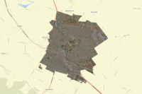
|
| GUID | N/A |
| Name | N/A |
| Title | City of Salinas Aerial Imagery 2025 |
| Type | Image Service |
| Type Keywords | ArcGIS Server, Data, Image Service, Metadata, Service |
| Description | N/A |
| Tags | nearmap, aerial imagery |
| Snippet | N/A |
| Extent | [-121.72999999999382, 36.608999999998154] - [-121.53699999999387, 36.761999999998125] |
| Spatial Reference | WGS_1984_Web_Mercator_Auxiliary_Sphere |
| Access Information | N/A |
| Classification | N/A |
| License Information | N/A |
| Culture | en-us |
| Properties | N/A |
| Advanced Settings | N/A |
| Url | https://salinas-gis.ci.salinas.ca.us/image/rest/services/Nearmap_Imagery/City_of_Salinas_Aerial_Imagery_2025/ImageServer |
| Proxy Filter | N/A |
| Last Modified | N/A |
| Size | 120 |
| Documentation | N/A |
| App Categories | N/A |
| Industries | N/A |
| Languages | N/A |
| Listed | false |
| Comments Enabled | true |
| # Comments | 0 |
| # Ratings | 0 |
| Avg. Rating | 0.0 |
| # Views | 173 |
| Categories | |
| Content Status |
Child Resources: Comments Rating Groups Item Data as Zip Item Dependencies
Supported Operations: Add Comment Add Rating Delete Rating Related Items Share Item Unshare Item Package Item Set Item Content Status